Frugal Travel Report for April 2010

This is the second in a series of reports detailing my travel expenses during a six-month sustainable travel trip through India, Vietnam, and Nepal, as outlined in The Plan: 6 Months, 3 Countries, and $3,000.

Frugal Travel Reports
March 2010 (includes Pre-Travel expenses)
April 2010
May 2010
June 2010
July 2010
August 2010

While its only been a few days since I released the March 2010 report, I want to get on schedule and release a new report at the start of each month.

During the month of April I spent more time in hotels and ate at restaurants more frequently than cooking for myself. The increased lodging and food expenses reflect this trend.

The entire month was spent living in Ujire, making new friends, working on my laptop at the office in town, and exploring nearby places like Jamalabad and Moodabidri. Continue reading

Frugal Travel Report for March 2010

Frugal Travel Reports
March 2010 (includes Pre-Travel expenses)
April 2010
May 2010
June 2010
July 2010
August 2010

***

As promised in my previous post, The Plan: 6 Months, 3 Countries, and $3,000, I will begin doing monthly travel reports that detail how I spend my budget each month as I travel through Asia. This monthly report may become a regular long-term thing, but for now I'm committing to doing them for at least the next six months.

My initial six-month journey has a very tight budget: $250 USD per month. I already outlined some of my first-month expenses in a previous post, but this report is a more formalized overview and explains how I actually lived on such a budget.

Frugal travel involves more than simply setting a budget and then looking for the cheapest places to stay. It also means traveling more slowly, always accepting invitations and offers to stay with friends, and choosing to have a more authentic experience by living like the locals.

Without the generosity of friends in India, I'm not sure I would have made the first month's budget. However, I don't have friends everywhere (at least not yet!), so once I move on from my current location in Ujire, meeting this budget will become a lot more challenging.

This first month was an opportunity to see just how realistic my $250/mo budget was and I'm happy to report that it's absolutely realistic! Continue reading

The Plan: 6 Months, 3 Countries, and $3000

I'm currently about a month and a half into my life-changing, soul searching, press-the-reset-button-on-life trip to India and I realized that I have yet to announce my plan for the next five months.

The word "plan" may be a little too concrete though; it's more like a rough outline. When I decided to uproot my life and switch to the lifestyle I had always dreamed of living, I knew that I needed some direction.

After all, how am I supposed to book a flight if I don't know where I'm going? Continue reading

Video: Eating a Cashew Fruit

[Note to email and RSS readers: You may need to click through to the website to view the video.]

Have you ever wondered what a cashew looks like straight from the tree? The farm where I'm staying in India has dozens of cashew trees growing (they're harvested for good money).

One day, while exploring the farm, a cashew fruit dropped from a tree and almost hit me on the head (maybe if it actually hit me I would have discovered a universal law). Continue reading

30 Interesting Things I Learned in India

My first day in India was quite interesting. Now that I've been in India for exactly 30 days, here are 30 interesting things that I have learned since I arrived.

  1. A hotel is actually a restaurant. Ask for "residence" if you want a place to stay for the night.
  2. If you're at a restaurant (or "hotel") and you want something "to go", you say you want it "parcel".
  3. An "overpass" is more commonly referred to as a "flyover".
  4. Vehicles and bikes use horns liberally; they're about as common as directionals (or "blinkers") are in the USA.
  5. Passing on the roads is a given, regardless of how dangerous a corner is or whether or not there is an oncoming vehicle.
  6. A combination of flashing headlights and horns are often used to convey the message to oncoming cars that they need to slow down because you're passing in the oncoming lane.
  7. Riding a bus (or jeep for that matter) feels somewhat like riding a roller coaster.
  8. When asking where I'm from, people guess the UK before the United States. (Maybe it's more common to find someone from Europe here?)
  9. Continue reading

My First $100 in India and a Message of Thanks

It's been almost one month since I arrived in India (26 days to be exact) and I have finally spent my first $100 USD (that's approximately 4,500 Rupees).

In fact, it was less than $100 because I got ripped off twice: The first time was with a $28 currency exchange fee when I changed a $100 bill for rupees during my layover at the Heathrow Airport in London.

The second time was when I stopped in a small town near Mangalore to refill my local Airtel SIM card: I gave the agent Rs.300, but when I was finally able to check the balance, it only showed Rs.1 (as I later learned, my unlocked iPhone didn't work with the local SIM, so I couldn't check the balance until I purchased a basic Nokia phone a few days later).

So, where exactly did those 2,940 Rupees go? Continue reading

My First Jeep Ride in India

There I was, walking around the busy center of town in Ujire, India, sweating more than everyone else around me and clearly not looking or feeling like a local. But I was already used to that. I've been into town twice now and the strange stares and odd looks are practically expected. I've discovered that if you stop looking at everyone in the eyes, it's easy to forget that they're staring.

It was about twenty past four in the afternoon and I was headed back home; a remote farm nestled in the foothills of the Western Ghats about 10 miles from town. I had two options for getting there: Wait for the bus and be crammed in with students headed home from school, or look for one of the jeeps and ride like a real local.

I noticed a bus arriving and waited to ask if it was headed to Kukavu (pronounced "kokow"), the name of the area about two miles from the farmhouse. The ticket attendant on the bus gave me a disgusted look and shooed me away. Continue reading

A Tour of the Farmhouse in Ujire, India

Here's a quick tour of the farmhouse I'm staying at in Ujire, India. It's relatively remote, about ten miles from town and about two miles from the main road.

The area where the farmhouse is situated is called Malajoti, a name given to it long before the current owner came into possession of it.

The mountains you see are part of the Western Ghats, which is "one of the world’s ten 'Hottest biodiversity hotspots' and has over 5000 species of flowering plants, 139 mammal species, 508 bird species and 179 amphibian species".

I'll work on making another video of the areas around the farm, which are really worth seeing!

Why India? Choosing the First Destination for my Nomadic Journey

When the news began spreading that I would be making a huge lifestyle transition and traveling the world, everybody I met drilled me with questions about where I was going. My answer was always the same: I told them that I hadn't yet decided but that I was open to going almost anywhere.

To my surprise, a large number of people began inviting me to stay with their relatives or friends in various countries around the world. When I realized how valuable such invitations would be on my journey, I began making a list. This list now includes places like India, Nepal, Taiwan, Australia, Ireland, Portugal, and South Africa!

The news reached a good friend of the family, Harish Hande, who was born in Bangalore, India and who travels there frequently for work. When he heard of my plans to become a nomadic world traveler, he offered to help me begin my journey by introducing me to some of his friends in Bangalore and giving me a place to stay for a few weeks.

I had originally planned to begin my journey by picking a random destination and finding places to stay using CouchSurfing.org. However, having a guaranteed place to stay and being introduced to trusted friends is a hard opportunity to pass up. Besides, India appealed to me for several reasons.

Nearly 25 years ago, as a 3 year old boy, I visited northern India with my parents. Since then, I haven't been to any other country (besides Canada, which all natural born citizens of the United States know doesn't count). Returning to the place that I visited as a child feels somewhat like a rebirth; like I’m continuing where I left off; like I'm getting off a detour and returning to the original path.

Even my name, Raam Dev, is of Indian origin and, despite the fact that my blood is almost as white as it could get, I grew up with traditions very similar to those of the Indian culture: We ate and slept on the floor, our home had no furniture and no television, we were strict vegetarian (no meat, fish, or poultry), and we meditated and chanted mantras daily.

So, of all the different cultures around the world, the Indian culture will probably be the easiest for me adjust to. I certainly plan to submerge myself in other, less familiar cultures, but India seems like a great place to begin my journey.

I'm sure much of what I think I know about India is wrong or misconstrued, but that's why I'm going there with an open mind. I'm not going there with a know-it-all mentality but rather with the expectation that I will learn and experience more than I am even capable of comprehending at this moment.

San Luis Reservoir, Route 99, and San Francisco

Golden Gate Bridge

As I left Mojave, CA (where I comfortably spent the night in Motel6 with free WiFi for $40) and drove along route 58, I found myself surrounded by windmills. California is one of the top states for renewable energy sources and it showed.

Right after the section of hills and windmills, I went through the small flat town of Tehachapi. The most stunning sight going through this town was a group of very tall pine trees sticking up out of the ground like giant blades of grass. As I left the flat plains, the landscape quickly became hilly again, but now with a twist: the landscape was littered with stunted trees.

Stunted Trees

Route 99 was mostly surrounded by fields, the occasional section of giant trees taller than anything else in view, and flowery bushes dividing the the highway itself. I stopped in Visalia, CA to get lunch at Panera Bread and use their free WiFi. The town, like many of the towns I went through, looked like it sprang up from out of the dry desert. People flocked to the new stores (Starbucks, Target, and Lowes are visible in the pictures) with their kids, many dressed in what looked like local farming clothes. It was easy to differentiate between long-time residents and the new people.

Visalia, CA

Going through Los Banos on route 152, huge winding canals carried water and looked like paved roads of their own. The San Luis Reservoir appeared out of no where and route 152 snaked around half the reservoir, climbing up the hills and opening up to amazing views. As I came down the other side of the hills, the landscape became thickly forested for a short while, no doubt fed by the water from the reservoir.

San Luis Reservoir

Entering the San Francisco area on route 101, the weather turned extremely cold; 55 °F! I had spent the past two days driving in 100+ °F weather and the change was a huge shock. The pine trees in Mountain View (considered part of Silicon Valley, home of Google, Microsoft, and others) made it clear that I was no longer in the desert. Many parts felt eerily similar to New England, except that everything was extremely clean and lots of people had hybrids and rode their bikes.

I then drove into San Francisco, a very hilly and foggy city. Much of the city smelled like burning firewood from the forest fires. I drove over the Golden Gate Bridge and took the first scenic stop on the right. I'm sure the views would have been even more incredible if it wasn't so cloudy.

Golden Gate Bridge Monument

There is a huge section of trails to the West, but I didn't have enough time to explore further. I headed back to the airport, returned the rental, and waited for the plane (it was delayed one hour). The plane left at 12:30am. Being a flight to Boston, MA, they offered Dunkin Donuts coffee on the flight. I hoped to get some sleep on the way, however the flight was very turbulent. I'm talking 30+ minutes of non-stop turbulence. People were vomiting, and even I was starting to feel sick (I don't get motion sickness very easily). The pilot tried going around it, but couldn't. Never the less, we landed safely in Boston at 8:30am and I took public transportation back to Central Square for $1.70. It took 35 minutes and we passed a $3.50 toll along the way. It was amazing how small everything looked when I got back; the rivers, the roads, the buildings, everything looked smaller.

California was an amazing place of diversity and I really look forward to going back. I'd like to live there at some point in the future.

Total miles driven: ~420

2008-06-23 Travel Map

Mojave Desert and Death Valley

Raam in Death Valley

I don't know what it is, but I love the desert. Endless roads, warm air (115°F), wind (it's hard to tell but in the picture above the wind is blowing 30+ mph), flat land that seems to go on forever, and of course, very few people.

Crossing the the border between Nevada and California, a desert mirage looked like a giant lake. A few minutes later, I spent about an hour covering 10 miles of I-15 due to a truck that turned over going through Mountain Pass. I entered the Mojave Desert from the North through Cima, CA. The US Post Office for Cima looked more like a shack in the middle of the desert until I saw the original Post Office:

US Post Office for Cima, CA

I tried driving up a dirt road, but turned around half way when I realized there was a chance I could get stuck (I had a Toyota Camry). So much for my sense of adventure.

Driving on I-40 the views were incredible (and so was the heat).

Before entering Death Valley, I thought of filling my gas tank. I decided to skip it when I saw the gas price was 4.91. Later, in Shoshone, CA, I ended up buying gas for 5.39 a gal. The sun was setting fast (and the smoke from the forest fires didn't help) and I wanted to get through Death Valley before the sunset.

The mountains and roadside were more barren than ever going through Death Valley. I read signs that said to be aware of the extreme heat and along a particular stretch of road there were "radiator water tanks" every few miles. I was passing through around 7PM and it was still 115 degrees, so I can't imagine how hot it must have been during the day.

Barren Death Valley

I was only half-way through Death Valley when it got dark. A big section of route 190 was through the mountain with roads that curved left and right a thousand times. Many of the corners had no guard rails and whenever I dared to take my eyes off the road and look down, all I could see was pitch black. It was definitely nerve racking going around each corner not being sure if there was a big rock lying in the middle of the road (plenty of signs warned me of that possibility). I saw dozens of snakes crossing the road during the night, but decided not to get a closer look and risk being stung in the middle of no where.

As I exited Death Valley and approached 395, I could see the mountains to the West glowing orange. I quickly realized they were forest fires and pulled over to take some pictures (timer, 30 sec exposure, the roof of the car, and the camera strap for balance). After taking the pictures I drove South on 395 and ended up going through all the smoke from the forest fires. Driving on the highway at 75 MPH in 110 degree weather, white ash started falling like snow. Animals that were running to escape the fire were on the left and right side of the highway. As I approached them, they would look up at me; their blue, gray, and green eyes shining through the thick smoke. It was very surreal.

Forest Fires

Total miles driven: ~580

2008-06-22 Travel Map

Vegas, Lake Mead, Valley of Fire, and Hoover Dam

Bellagio

Friday night Sanjay dropped me off in front of the Bellagio on his way to the airport. The Strip was crowded as hell. I noticed everyone was looking out towards the Bellagio and realized they were waiting for the fountains to start. I found a good place to steady my camera and when it started I took some photos of the fountain.

Then I looked for the fastest, cheapest way out of there! It had only been about 20 minutes and I was already sick of the place. I took the monorail back to the Hilton for $5 and then caught a cab to the Plaza Hotel, which was North of The Strip. $12 including tip.

The Plaza Hotel was crap. I got a smoking room (they didn't ask me what I wanted), the TV was broken (it turned on and off randomly), and when I fell asleep with the TV on, a security guard opened my hotel room door, woke me up and asked me to turn down the TV... at 2:30 in the morning.

The next morning I needed to find a way to the airport to pick up my rental car. The person at the front desk said the shuttle to the airport arrives every 1.5 hrs and that a cab costs about $25 to the airport.

After having a coffee and waiting around a bit inside, I decided to get some fresh air and sit outside (the ceiling of the place was covered in bulbs). When I asked the security guard about the shuttle, she said it arrives every 30 minutes, but that it will most likely be full because it requires that you reserve a spot. She also said it has lots of stops and that it will take awhile to get to the airport. She said a cab is about $40 and that I should take the city bus; it comes every 30 minutes and is a lot cheaper. However it's a long 1 hour ride to airport because it makes lots of stops.

So I walked half a block and waited for city bus. When it arrived, I realized I only had a $1 dollar bill and a $20 bill (fare was $1.25). The driver said he has no change and that I should go find change elsewhere. As soon as the bus drove away, I realized I had 25 cents in my LEFT pocket (normally I only put money and change in my right pocket).

So I decided to wait for shuttle and ask the driver if there was room. He came 10 minutes later, I paid him 8 bucks. I was the only one on the shuttle, and he went straight to the airport in 15 minutes.

There was a single building for all the car rentals and the place looked like a mini airport! There were about 100 people in line for the shuttle back to the airport.

When I purchased something at the concession stand, the persona at the register said, "Have the best day!" instead of, "Have a good day!". I later realized a lot of people in Nevada said "Have the best day".

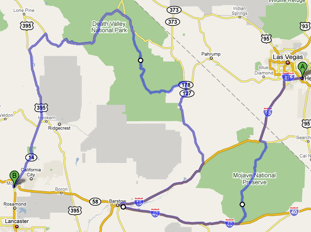
The car I rented was a Toyota Camry. It was rated at 35 MPG (I later tested my real fuel economy and discovered I was getting 37 MPG). The rental for three days was a bit expensive, but since I knew I would be doing around 1,000 miles and with gas prices where they were (between 4.50 and 5.80 a gal out West), having good fuel economy would definitely be worth the extra cost (I ended up doing 1,241 miles over the three days).

Toyota Camry

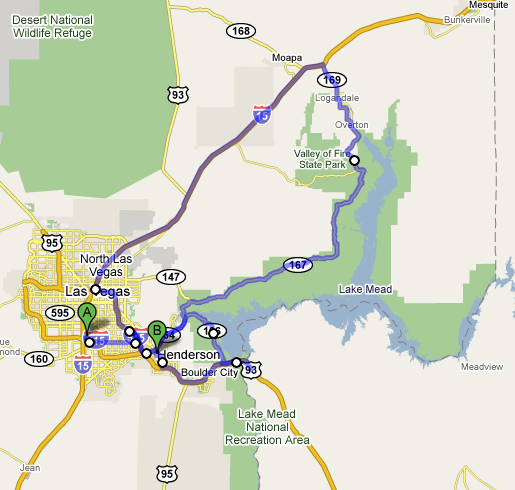
After picking up the rental, I drove towards Lake Mead on E Lake Mead Pkwy and then realized a better route would be to come down through the Valley of Fire. So I went back, took I-515 North to I-15 North, and came down route 167 through Logandale and Overtron.

Valley of Fire

Finally, I took route 147 to 166, and then onto 93 where I visited Hoover Dam. They were rebuilding the 93 highway with a new bridge that goes across the dam. I can see why. The current roads are very narrow and easily create a bottleneck in the flow of traffic.

New 93 Bridge over Hoover Dam

I stopped briefly in Boulder City (which was beautiful) and then found a place to stay in Henderson, NV called Hawthorne Inn. This room was much, much nicer than the Plaza Hotel and it only cost me $50!

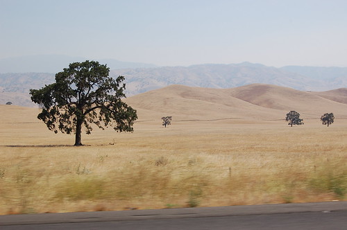
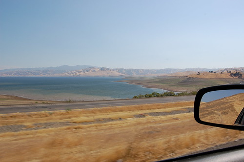
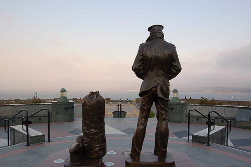
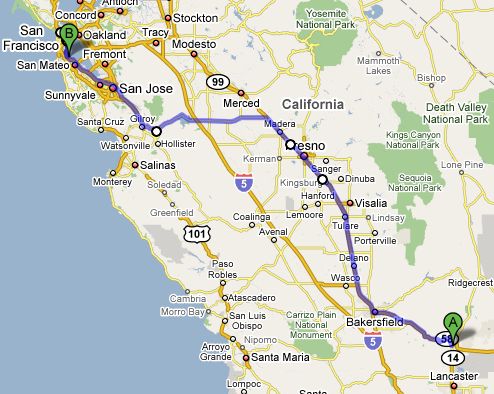
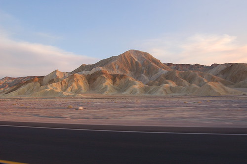
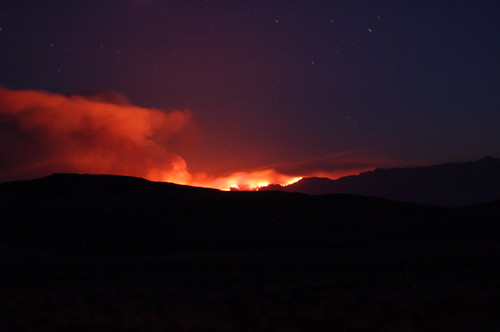
I will let the pictures and the map do the rest of the talking. Keep in mind that I took the majority of the pictures while driving. I just held my DSLR in one hand, and stuck it out the window over the passengers seat (yes, I kept a hand, and my eyes, on the road). Keeping the camera level was difficult and I had to learn how to judge where I was pointing the camera without actually looking through the viewfinder. With the amount of driving I was planning on doing, I couldn't afford to stop and take pictures!

Total miles driven: ~240

Route Driven 2008-06-21