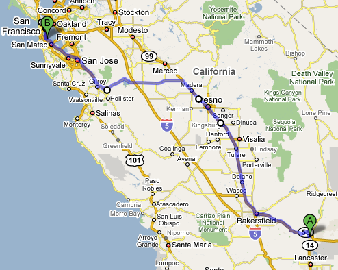
As I left Mojave, CA (where I comfortably spent the night in Motel6 with free WiFi for $40) and drove along route 58, I found myself surrounded by windmills. California is one of the top states for renewable energy sources and it showed.
Right after the section of hills and windmills, I went through the small flat town of Tehachapi. The most stunning sight going through this town was a group of very tall pine trees sticking up out of the ground like giant blades of grass. As I left the flat plains, the landscape quickly became hilly again, but now with a twist: the landscape was littered with stunted trees.
Route 99 was mostly surrounded by fields, the occasional section of giant trees taller than anything else in view, and flowery bushes dividing the the highway itself. I stopped in Visalia, CA to get lunch at Panera Bread and use their free WiFi. The town, like many of the towns I went through, looked like it sprang up from out of the dry desert. People flocked to the new stores (Starbucks, Target, and Lowes are visible in the pictures) with their kids, many dressed in what looked like local farming clothes. It was easy to differentiate between long-time residents and the new people.
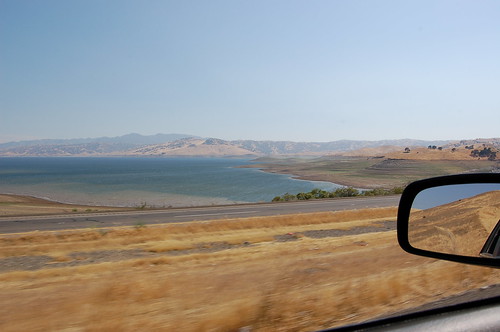
Going through Los Banos on route 152, huge winding canals carried water and looked like paved roads of their own. The San Luis Reservoir appeared out of no where and route 152 snaked around half the reservoir, climbing up the hills and opening up to amazing views. As I came down the other side of the hills, the landscape became thickly forested for a short while, no doubt fed by the water from the reservoir.
Entering the San Francisco area on route 101, the weather turned extremely cold; 55 °F! I had spent the past two days driving in 100+ °F weather and the change was a huge shock. The pine trees in Mountain View (considered part of Silicon Valley, home of Google, Microsoft, and others) made it clear that I was no longer in the desert. Many parts felt eerily similar to New England, except that everything was extremely clean and lots of people had hybrids and rode their bikes.
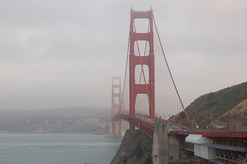
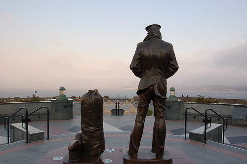
I then drove into San Francisco, a very hilly and foggy city. Much of the city smelled like burning firewood from the forest fires. I drove over the Golden Gate Bridge and took the first scenic stop on the right. I'm sure the views would have been even more incredible if it wasn't so cloudy.
There is a huge section of trails to the West, but I didn't have enough time to explore further. I headed back to the airport, returned the rental, and waited for the plane (it was delayed one hour). The plane left at 12:30am. Being a flight to Boston, MA, they offered Dunkin Donuts coffee on the flight. I hoped to get some sleep on the way, however the flight was very turbulent. I'm talking 30+ minutes of non-stop turbulence. People were vomiting, and even I was starting to feel sick (I don't get motion sickness very easily). The pilot tried going around it, but couldn't. Never the less, we landed safely in Boston at 8:30am and I took public transportation back to Central Square for $1.70. It took 35 minutes and we passed a $3.50 toll along the way. It was amazing how small everything looked when I got back; the rivers, the roads, the buildings, everything looked smaller.
California was an amazing place of diversity and I really look forward to going back. I'd like to live there at some point in the future.
Total miles driven: ~420


Las Vegas = HillBilly
Visalia = Fledermaus
And you prolly flew over the top of me
Anyhow, looks like some great scenery. The picture of the stunted trees looks like a painting.
Oh, why did you not go along the coast?? It’s ok…I have pictures for you. 🙂
Because I wanted to do something out of the ordinary… everyone goes along the coast! Also, I was visiting a friend in Fresno, so logistically it made more sense. 🙂