Together

A whisper, “look!” In the flow, we go; traversing the land, not separate, but in sync, in silence. Step. Thought. Step. No thought. We exist, woven by time into the fabric of now. In fields of gold we lie, on a plateau, greeted by acrobats of the sky. An oasis, an adventure, a walk beside the mountain. In the breeze, between the trees, in the green valley caressed by the sea, we sit.

A whisper, “there!” Time frozen. Beauty, an earthly embrace shared not by two, but three! On a hair of grass, in the wind, motionless, a hummingbird floats. A heartbeat, its wings move like magic and we smile. In the moment, in the beauty of the present, there is no ‘other’, no separation, no tomorrow, only now, only ‘one’. Together.

San Luis Reservoir, Route 99, and San Francisco

Golden Gate Bridge

As I left Mojave, CA (where I comfortably spent the night in Motel6 with free WiFi for $40) and drove along route 58, I found myself surrounded by windmills. California is one of the top states for renewable energy sources and it showed.

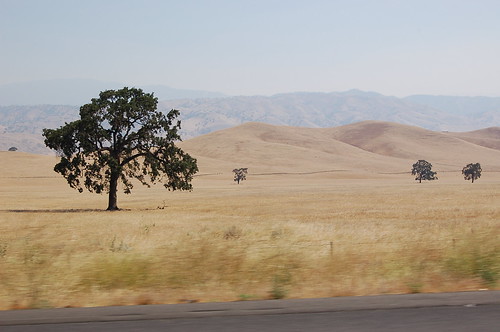
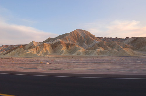
Right after the section of hills and windmills, I went through the small flat town of Tehachapi. The most stunning sight going through this town was a group of very tall pine trees sticking up out of the ground like giant blades of grass. As I left the flat plains, the landscape quickly became hilly again, but now with a twist: the landscape was littered with stunted trees.

Stunted Trees

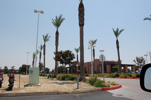
Route 99 was mostly surrounded by fields, the occasional section of giant trees taller than anything else in view, and flowery bushes dividing the the highway itself. I stopped in Visalia, CA to get lunch at Panera Bread and use their free WiFi. The town, like many of the towns I went through, looked like it sprang up from out of the dry desert. People flocked to the new stores (Starbucks, Target, and Lowes are visible in the pictures) with their kids, many dressed in what looked like local farming clothes. It was easy to differentiate between long-time residents and the new people.

Visalia, CA

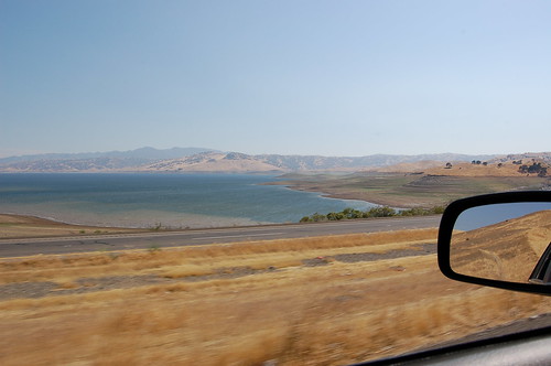
Going through Los Banos on route 152, huge winding canals carried water and looked like paved roads of their own. The San Luis Reservoir appeared out of no where and route 152 snaked around half the reservoir, climbing up the hills and opening up to amazing views. As I came down the other side of the hills, the landscape became thickly forested for a short while, no doubt fed by the water from the reservoir.

San Luis Reservoir

Entering the San Francisco area on route 101, the weather turned extremely cold; 55 °F! I had spent the past two days driving in 100+ °F weather and the change was a huge shock. The pine trees in Mountain View (considered part of Silicon Valley, home of Google, Microsoft, and others) made it clear that I was no longer in the desert. Many parts felt eerily similar to New England, except that everything was extremely clean and lots of people had hybrids and rode their bikes.

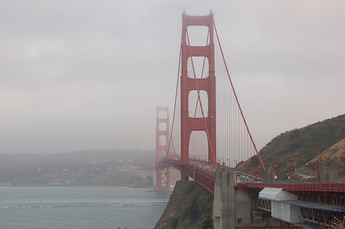
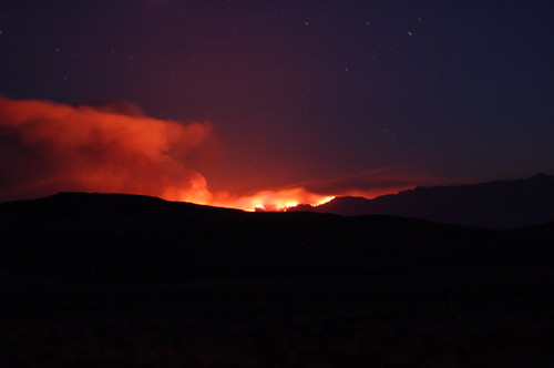
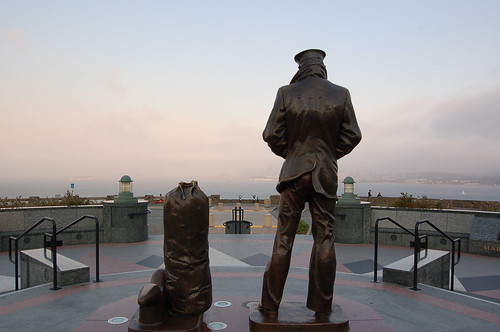
I then drove into San Francisco, a very hilly and foggy city. Much of the city smelled like burning firewood from the forest fires. I drove over the Golden Gate Bridge and took the first scenic stop on the right. I'm sure the views would have been even more incredible if it wasn't so cloudy.

Golden Gate Bridge Monument

There is a huge section of trails to the West, but I didn't have enough time to explore further. I headed back to the airport, returned the rental, and waited for the plane (it was delayed one hour). The plane left at 12:30am. Being a flight to Boston, MA, they offered Dunkin Donuts coffee on the flight. I hoped to get some sleep on the way, however the flight was very turbulent. I'm talking 30+ minutes of non-stop turbulence. People were vomiting, and even I was starting to feel sick (I don't get motion sickness very easily). The pilot tried going around it, but couldn't. Never the less, we landed safely in Boston at 8:30am and I took public transportation back to Central Square for $1.70. It took 35 minutes and we passed a $3.50 toll along the way. It was amazing how small everything looked when I got back; the rivers, the roads, the buildings, everything looked smaller.

California was an amazing place of diversity and I really look forward to going back. I'd like to live there at some point in the future.

Total miles driven: ~420

2008-06-23 Travel Map

Mojave Desert and Death Valley

Raam in Death Valley

I don't know what it is, but I love the desert. Endless roads, warm air (115°F), wind (it's hard to tell but in the picture above the wind is blowing 30+ mph), flat land that seems to go on forever, and of course, very few people.

Crossing the the border between Nevada and California, a desert mirage looked like a giant lake. A few minutes later, I spent about an hour covering 10 miles of I-15 due to a truck that turned over going through Mountain Pass. I entered the Mojave Desert from the North through Cima, CA. The US Post Office for Cima looked more like a shack in the middle of the desert until I saw the original Post Office:

US Post Office for Cima, CA

I tried driving up a dirt road, but turned around half way when I realized there was a chance I could get stuck (I had a Toyota Camry). So much for my sense of adventure.

Driving on I-40 the views were incredible (and so was the heat).

Before entering Death Valley, I thought of filling my gas tank. I decided to skip it when I saw the gas price was 4.91. Later, in Shoshone, CA, I ended up buying gas for 5.39 a gal. The sun was setting fast (and the smoke from the forest fires didn't help) and I wanted to get through Death Valley before the sunset.

The mountains and roadside were more barren than ever going through Death Valley. I read signs that said to be aware of the extreme heat and along a particular stretch of road there were "radiator water tanks" every few miles. I was passing through around 7PM and it was still 115 degrees, so I can't imagine how hot it must have been during the day.

Barren Death Valley

I was only half-way through Death Valley when it got dark. A big section of route 190 was through the mountain with roads that curved left and right a thousand times. Many of the corners had no guard rails and whenever I dared to take my eyes off the road and look down, all I could see was pitch black. It was definitely nerve racking going around each corner not being sure if there was a big rock lying in the middle of the road (plenty of signs warned me of that possibility). I saw dozens of snakes crossing the road during the night, but decided not to get a closer look and risk being stung in the middle of no where.

As I exited Death Valley and approached 395, I could see the mountains to the West glowing orange. I quickly realized they were forest fires and pulled over to take some pictures (timer, 30 sec exposure, the roof of the car, and the camera strap for balance). After taking the pictures I drove South on 395 and ended up going through all the smoke from the forest fires. Driving on the highway at 75 MPH in 110 degree weather, white ash started falling like snow. Animals that were running to escape the fire were on the left and right side of the highway. As I approached them, they would look up at me; their blue, gray, and green eyes shining through the thick smoke. It was very surreal.

Forest Fires

Total miles driven: ~580

2008-06-22 Travel Map