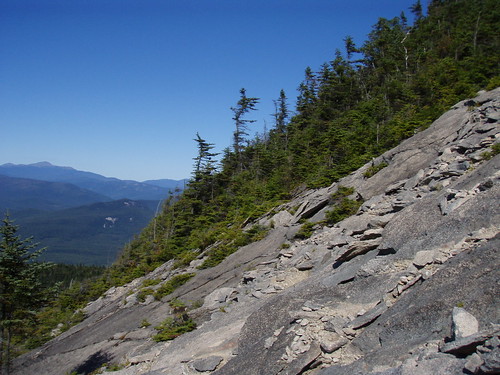
Mt. Jackson & Mt. Webster

On Top of Mt. Jackson

This past Monday I hiked Mt. Jackson, checking off another 4k footer from the list of 48 in NH. The trailhead was located off RT302, right next to Crawford Notch in the heart of the White Mountain National Forest. At the base, the temperature was around 40 degrees Fahrenheit, so I expected much colder temps at the summit and prepared accordingly.

It was a steady climb up; there were only a few places where I didn't feel like I was climbing stairs. Since I was constantly moving, my body warmed up and I ended up storing most of the warm clothing in my bag during the hike. Most of the landscape was lush -- even tropical (it's hard to imagine for New England, but there are rain forests here!).

Somewhere around 3,500', I looked up and the tops of the trees were covered in something white. I realized it was ice! At the same time, I noticed the wind was blowing incredibly strong just 15' above me; the clouds, so close I felt like I could reach out and touch them, were whipping by as if on a racetrack. From that point onward, things just got colder.

When I reached the summit, everything was frozen. It was incredible. The wind was gusting so strongly that I struggled to maintain my balance. I took off one of my gloves to take pictures and within thirty seconds I couldn't feel my fingers! There were 360-degree views of the surrounding Presidentials -- absolutely stunning.

I decided to take the Mt. Webster loop back instead of going the same way I came. It was an extra 1.6 miles, but I was in no rush. But before I left the summit, I heard a bird whistling to me. I looked over and there he was, perched ten feet in front of me on a frozen pine branch. Realizing I was on part of the Appalachian Trail, I suspected he might be accustom to being fed by passing hikers. I opened a food bar and sure enough, he ate right out of my hand!

The hike from the summit of Mt. Jackson to the summit of Mt. Webster was mostly easy-going terrain. There were lots of slippery log walkways winding through swampy areas that were overgrown with green moss. It was also still cold (the trees were still under 15', and I was still exposed to the strong winds).

Overall, it was an incredible hike. The four and a half hours felt more like eight and the changing landscape, high winds, and friendly wildlife made the trip exhilarating. I didn't pass a single person on the entire hike, probably due to the fact that it was Monday. šŸ™‚

Date of Hike
2009/11/16

Hiking Time
Total Time (including breaks): 4 hours
Book Time: 4-5 hours

Hiking Distance
Round Trip: 5.73 miles

Total Climb
2,232′

Runkeeper Stats

Mt. Tecumseh

On Labor Day, I hiked Mt. Tecumseh, the lowest of the official 48 four thousand footers in NH. The trail starts just below the Waterville Valley ski area base camp (slightly back down the road on the right side, if you're facing the base camp). The first two miles of the trail were beautiful and well maintained. In some parts, the forest was so lush it felt tropical. After the first lookout (where the above picture was taken), the trail becomes a lot more unforgiving and you're basically doing stair climbers on rocks for a mile and a half (my thighs ached for days afterwards).

The summit area was extremely lush and the peak offered a nice view. I took a nap at the summit, snapped some pictures of a beautiful sky, watched a mouse scramble out from underneath a rock looking for scraps, and eventually ended back down.

Instead of going back the same way I came, I took the Sosman Trail over to the top of the ski trails. The panoramic view was indescribably stunning, but unfortunately by this time my camera had run out of battery. (I was, however, able to snap two pictures half way down.) Having an unobstructed view from the top all the way down to the base lodge was incredible and being on such a grassy hillside definitely made me feel like I wasn't in New England anymore. I switched between jogging, walking, and limping down the ski trails. My feet were in a lot of pain from the previous day's hike and from all the down-angled terrain, but at the same time I wanted to get down faster so the pain would cease.

Date of Hike
2008/09/07

Hiking Time
Total Time (including breaks): 4 hours
Book Time: 3.5 hours

Hiking Distance
Round Trip: 9.6 miles

Total Climb
2,328′

Mt. Tripyramid (North & South Peak)

North Slide on Mt. Tripyramid

On Labor Day weekend, I hiked Mt. Tripyramid, one of the official 48 four thousand footers in NH. The trail starts out with a relatively easy 3 mile walk along Livermore Rd. I went past the South Peak trail and took the North Peak trail instead. This trail went up the very steep North Slide (which is where the above picture was taken from); the rock face was very bare in some spots, requiring me to find cracks in the rock to hold myself down as I climbed. The panoramic view from the North Slide was awesome. The Waterville Valley ski area and Mt. Tecumseh, the mountain I climbed the following day, was clearly visible. There were times on the North Slide where I had no idea where the trail was (stay to the right on the slide!) but it eventually lead to a very dense forest.

Once inside the forest, the trail almost disappeared. There was a spot where I thought the trail branched off to the right, but after getting confused and exploring it, I determined it lead nowhere. The trail continues straight up and off to the left (the maps don't show this at all) through very dense bushes (you can't even see the ground while going through them). There was one spot on a rock in the dense bushes where the view opened up to the South.

There weren't many views from the North Peak. The trail continued along the ridge through thick forest to Middle and finally South Peak. I took the South Slide back down, which had a lot more loose rock, but felt much safer than the very steep North Slide.

After the South Slide, the trail continued through the forest and eventually lead back to Livermore Rd. From there, I had the long 3 mile walk back to the parking lot.

I used a new app on my iPhone called RunKeeper to track my hike using the built-in GPS. You can see elevation, speed, and the route:

Date of Hike
2009/09/06

Hiking Time
Total Time: 5 hours 42 minutes
Book Time: 7 hours

Hiking Distance
Round Trip: 10.5 miles

Total Climb
3,289′

Mount Osceola

Mount Osceola (4,340'), named after an Indian war chief of the Seminole Indians in Florida (misappropriation of Native American names was not unusual in the 19th Century), was an excellent half-day hike. The Mount Osceola Trail branches off the Greely Ponds Trail and is accessible from the Greely Ponds trailhead.

The trail quickly started its ascent, becoming quite steep at times, with the East peak looming overhead. When I did finally reach the East peak at 4,156', the in-your-face panoramic view was both incredible and dizzying. The East peak view point is extremely steep; a huge jagged clump of rocks angled in such a way they seemed to shout "don't trip here, or it will be a painful slide down!". Upper Greely pond is also visible from here and having visited it only an hour earlier made me appreciate the distance that much more.

After another short burst of unforgiving, steep trail, I reached the summit-with-views. I call it that because the true summit, which can be seen from here and is a relatively short and easy hike, has very limited panoramic views.

I didn't stay at the summit long and decided to take a break at the summit-with-views instead. Amazingly, the Northwest side of Mount Washington, the highest peak in the American Northeast, can just barely be seen from here (center of picture, behind the foreground peak, just barely visible).

Also visible from here, and probably more incredible for me, is Mount Hancock, which I climbed the previous day. It has a distinguishable ā€œVā€ rock slide, which can be seen in several of the pictures I took from Mount Osceola. The V can be seen in the center of this picture and here is a closeup of the rock slide I took the previous day.

Date of Hike
2007/09/03

Hiking Time
Parking Lot to East peak: 50 minutes
East peak to Summit: 30 minutes
Total Time: 2 hours 40 minutes
Book Time: 4 hours

Hiking Distance
Round Trip: 5.6 miles

Total Climb
2,250'

Upper Greely Pond

This hike was part of the three days of hiking I completed this past Labor Day weekend. I wasn't actually planning to visit Greely Pond. In fact, I was on the trail to hike Mount Osceola (I'll post that next). However it was only a short, 0.3 mile detour to Upper Greely Pond, so I decided to go for it.

The trail leading to Upper Greely Pond was simple enough, though it did require walking over log bridges and crossing streams along the way. Mount Osceola's East peak soars above the pond and is where I was headed next.

The two ponds, Upper and Lower Greely Pond (I only visited the Upper pond) are nestled inside Mad River Notch. The Greely Pond Trail actually leads all the way across to Waterville Valley, about 3 miles away.

Mount Hancock (North and South Peaks)

Mount Hancock (4,420') was once one of the most inaccessible mountains in the White Mountains. It was remote, void of any trails, and was devastated by logging. It's now full of life and is one incredible hike! I hiked this mountain as part of my Labor Day hiking marathon. The trail head is located off the Kancamangus Highway, just past the Greely Ponds trail, labeled the Hancock Notch Trail.

The first part of the hike, crossing mostly flat ground, was as easy as the hike up the North peak was difficult. The sound of cars along the Kancamangus Highway disappeared more quickly than I imagined they would. After 1.7 miles, I reached the trail junction of the Hancock Notch Trail and the Cedar Brook Trail. From there I traveled along the Cedar Brook Trail for 0.7 miles over slightly more rugged terrain to the junction where the Hancock Loop Trail branches off to the right. Another 1.1 miles and I reached the Hancock Loop Junction. From here on, the trails were nothing short of difficult. Just before reaching the loop junction, I passed a group of hikers on their way back who told me I should take the North peak up and the South peak down, because the rock was a lot more loose on the South peak. I had planned to take the North peak anyway, but it was nice to know a group of people survived the same route I planned on taking.

As I headed towards the North peak, I noticed in the distance a huge rock slide in the shape of a V on the mountain in front of me. I later learned (on my hike up Mount Osceola) that this was a distinguishable feature of Mount Hancock that made it easy to identify from a distance. In the back of my mind, I hoped that wasn't the trail up the mountain.

After crossing a dry river bed, the trail became more and more difficult. The most difficult and steep part was a 1/2 mile section of the hike which climbs over 1,000 ft in elevation. There are several sections of the trail that have enough trees cut to give you a taste of the view at the top. And the view at the top of North peak was incredible. Mount Osceola and Carrigain are clearly visible from here. I didn't know it at the time, but I would be climbing Mount Osceola the following day!

After a short 20 minute break, I traveled across the mountain to the South peak (4,274'), 1.4 miles away, over very easy ground (a relief after hiking North peak!). It was quite amazing how clean and untouched everything was along the trail at the top of the mountain -- it was almost fairy-tale like. When I arrived at South peak, there were nice views to the East and North, though nothing quite as panoramic as the outlook on North peak. As I descended back down to the loop junction, I could see the side of Hancock I climbed earlier, as well as the distinguishable "V" rock slide. Maybe it was just my imagination, but the decent down South peak seemed very short and not nearly as difficult as ascent up North peak. From here, I hiked back to the parking lot the way I came.

Date of Hike
2007/09/02

Hiking Time (including breaks)
Parking Lot to North peak: 2 hours
North peak to South peak: 40 minutes
South peak to Parking Lot: 1 hour 40 minutes

Hiking Distance
Round Trip: 9.4 miles

Little Haystack via Falling Waters Trail

Me on Little Haystack

Little Haystack (4,840') is a part of the Franconia Range in the White Mountains of New Hampshire. I hiked to this peak with my sister Meera and my brother-in-law Thea.

We started the hike from the Old Bridle Path parking lot, which is located off I-93N. The exit is marked "Trail Head - Old Bridle Path". From there, we took the Falling Waters Trail to the peak of Little Haystack. The trail varied between being easy and difficult and we passed several waterfalls along the way. I was disgusted by how inconsiderate some people are, leaving a bag of trash under a rock along the trail. I later regretted not taking the bag back to the parking lot with me when I realized I could have done something to help protect the environment.

Since I am someone who is often bothered by the knowledge of germs, I was taken aback when I noticed how every tree that was positioned in the right place to assist people along the trail, was soaked with oil from the many hands that had come in contact with it. I avoided these trees at all cost for the rest of the hike, as well as on my other hikes.

Trail Map

When we arrived at the top of Little Haystack, above the alpine zone and above the tree line, the temperature dropped dramatically. It was about 85 degrees when we started the hike and at the top, with the fierce wind, it was around 30 degrees! Everyone was wearing winter hats and winter clothes. I was freezing, but I was happy I remembered to bring a sweatshirt! The other two peaks, Mount Lincoln and Mount Lafayette, are both visible from the top of Little Haystack. You could even see the parking lot where we started. Due to the cold weather, we decided not to hike any further and went back down the Falling Waters Trail the way we came.

Date of Hike
2007/09/01

Hiking Time (including breaks)
Ascend time: 2.5 hours
Descend time: 1.5 hours

Hiking Distance
Round Trip: 7 miles